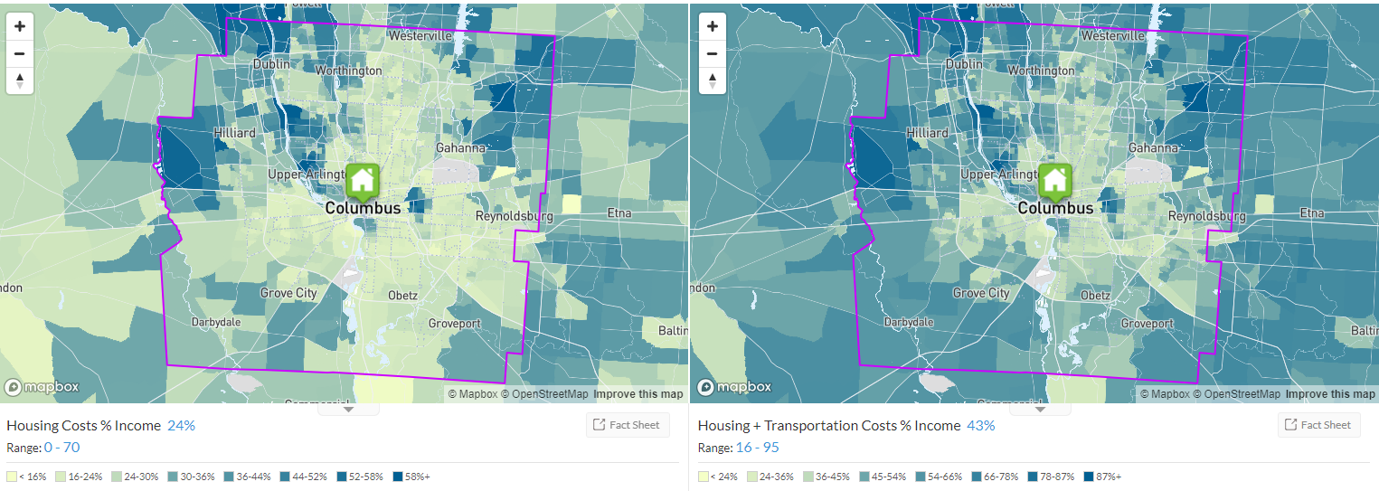
What can I do with the data? The Housing and Transportation (H+T®) Affordability Index provides a comprehensive view of affordability that includes both the cost of housing and the cost of transportation at the neighborhood level.
Traditional measures of housing affordability ignore transportation costs. Typically a household’s second-largest expenditure, transportation costs are largely a function of the characteristics of the neighborhood in which a household chooses to live. Location Matters. Compact and dynamic neighborhoods with walkable streets and high access to jobs, transit, and a wide variety of businesses are more efficient, affordable, and sustainable.
By taking into account the cost of housing as well as the cost of transportation, H+T provides a more comprehensive understanding of the affordability of place. Dividing these costs by the representative income illustrates the cost burden of housing and transportation expenses placed on a typical household. While housing alone is traditionally deemed affordable when consuming no more than 30% of income, the H+T Index incorporates transportation costs—usually a household’s second-largest expense—to show that location-efficient places can be more livable and affordable.
Look at all the data I generated in 10 seconds for the city of Columbus!
This is incredibly interesting data, and very useful. For example, Columbus residents spend about 19% of their income on transportation costs, and 21% of their income on housing costs. Housing + Transportation Costs are 39% of income!! Does that seem like a lot?
Compare the Housing and Transportation as a % of Income for the city of Los Angeles?
How can I download the data? Downloading the data is easy, but you do have to register. Click here to access the data and register. Once you register, you only need to enter your email address to access the data.
Let's take a look at the data dictionary which you can view online here
You can make comparison maps such as the one I made below. You can tell that housing + transportation effects people living in the southwest portion of franklin county moreso than housing costs alone.
This seems to make sense, as the need to drive farther to get to their place of employment (which is probably OSU -- to get a better sense of workflows, you can use the OntheMap dataset from the Census which is SUPER cool!!.
Using the OnTheMap tool, I can see where workers live, where workers work, and a host of other characteristics. We will use the tool, but the data can be downloaded and analyzed (since this can be very complicated and tricky, I won't demonstrate it here, but reach out if you want to use these data in the future!)
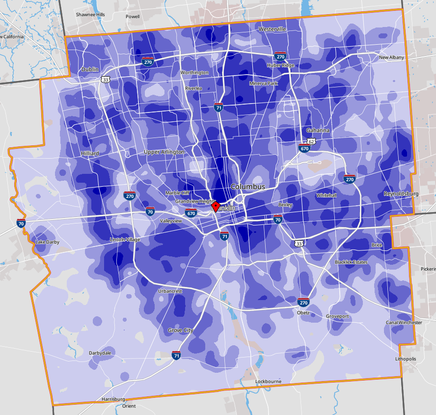
Where Workers Live
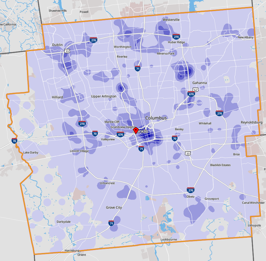
Where workers Work