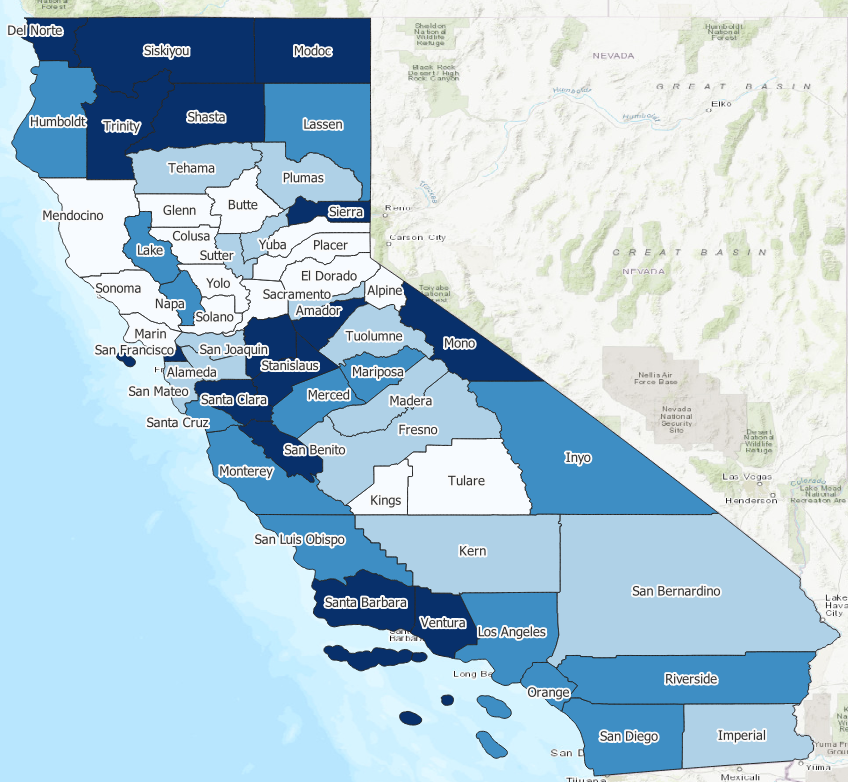
RQ2: Are there geographic differences in discharge dispositions across the state of California?
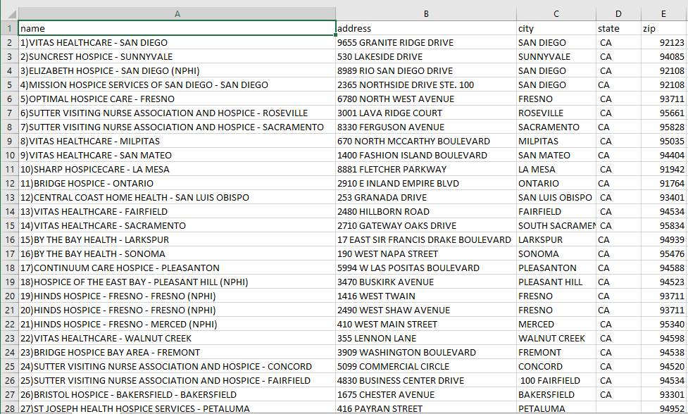
It would be more informative if we know the location of hospice facilities across the state. Luckily, a google search identified the following website: Hospices in CALIFORNIA (nationalhospicelocator.com)
This is an example of data that is not in the proper format but that can be analyzed after it is processed. In order to process these data, I followed these steps:
- I copied the locations of each hospice facility and pasted it into excel. I deleted all of the unnecessary fields and kept all address fields (street, city, zip) and the location name.
- I saved the file as a .csv called hospice.csv. The first few lines of the csv file are provided below.
- I opened the file in QGIS
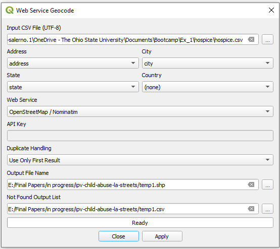
- I used the MMQGIS pluginto geocode the data. From the file menu select MMQGIS --> Geocode --> Geocode CSV from web service.
- The trick is to select the OpenStreetMap Web Service in the box below. Google requires payment and an API key, don't use that (see image).
- The trick is to select the OpenStreetMap Web Service in the box below. Google requires payment and an API key, don't use that (see image).
Select a temporary file to store any of the locations that are not found. My file is called temp1.csv. You must choose a folder that QGIS can write to or this will fail. You can see which addresses were not geocoded and geocode them manually using google maps. We won't do that, and of course its only possible if there are a handful or so such locations. Once the procedure finishes, the locations will appear on the map we made.
Do you notice anything interesting about the locations?
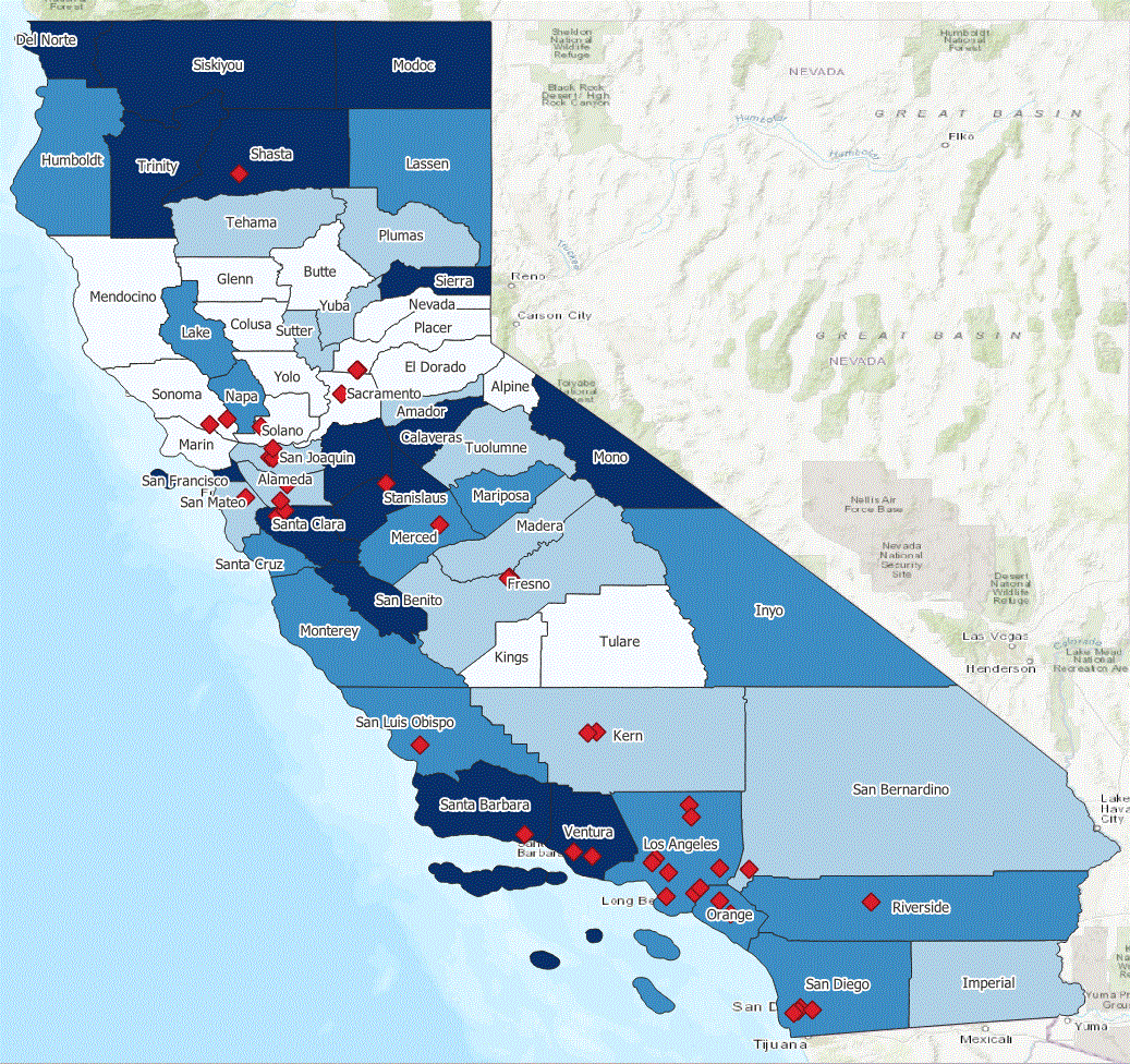
Figure 2. Map of Number of Referrals to Hospice by County and Hospice Care Facilities